What are Aids to Navigation in Maritime?

When on the road, we have signs and lights that regulate, warn, or inform us as we drive or pass by. Each of these devices and signals helps motorists and pedestrians alike to keep safe on the road.
But unlike our manmade or paved highways, waterways do not have road signs indicating our location, the route or distance to our destination, or the hazards along the way.
What the waters have, though, is equipment that helps navigation, generally for those in maritime or air travel.
So, what are these Aids to Navigation (ATONs), and why should seafarers always be mindful of them? Let’s find out!
A history of ATONs
Whether we like it or not, many of us take marine aids to navigation for granted and don’t even realize how dependent we are on them until they need to be changed.
After installation, the majority of navigational aids merely need routine maintenance.
They then pretty much effectively continue their work, and mariners, harbor masters, and other seafarers have one less thing to manage.

But it wasn’t always like that. The original navigational aids were quite a handful.
Fires lighted on hilltops to indicate the location of the safe route were used to direct early mariners into port. These had to be watched to ensure the flame didn’t go out and were constructed on platforms for better view.
These first platform fires led to the development of the lighthouse.
The earliest lighthouse, according to records, was built in the fifth century BC. This was a stone tower with a fire beacon erected on top in the harbor of Piraeus, Greece.
The famed Pharos of Alexandria, often known as the Lighthouse of Alexandria, was built two centuries later.
A lighthouse keeper would undoubtedly have had a difficult job keeping the beacon lit because these early lighthouses were illuminated on a top stage in the tower.
They would have had to carry fuel, typically heavy because it was either wood or coal, up the tower to the platform, keep the fire going all night, and protect it from gales and bad weather.

Although we can still see lighthouses being used nowadays, navigational aids have developed into the less laborious and sustainable types that mariners frequently use today.
The modern navigation aids
The phrase “aids to navigation” refers to objects that serve as “street” signs on the water, including buoys, day beacons, lights, lightships, radio beacons, fog signals, markings, and more.
All the auditory, visual, and electronic symbols established by public and private entities for use by pilots are referred to as aids to navigation.
The Coast Guard is the organization in charge of maintaining navigational aids on American seas that fall under federal control or are used by the U.S. military.
The Coast Guard delegated to state the obligation of creating and maintaining aids to navigation on bodies of water that are entirely within the borders of a single state but are not navigable to the sea.
So, what are these auditory, visual, and electronic symbols that will help ensure your life at sea is safe and right on track?
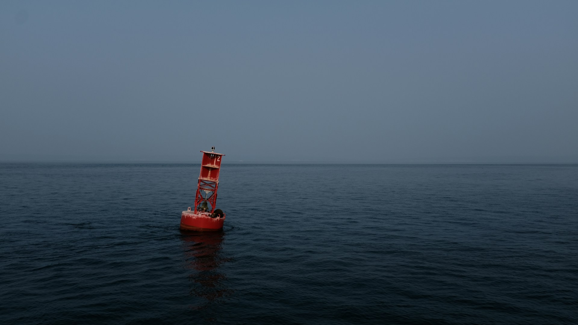
These navigational guides can either be floating (buoys) or fixed (beacons).
Buoys are a type of floating device with a bottom anchor. They can be avoided by recognizing them by their distinctive shapes and colors, which also reveal their function.

Beacons are permanent structures that are anchored to the ground or the seabed.
They include single-pile poles and buildings like lighthouses. Most beacons are equipped with lateral or non-lateral assists. Day Beacons are those that are not lit; lights are those that are lit.
Both buoys and beacons may feature lights and sound-producing equipment like a gong, bell, or horn. In addition, beacons and buoys can be referred to as “markings.”
Other navigational aids you might come across are referred to as “marks.”
1. Dayboards
The vessel operator can use these diamond-shaped markers to locate their position on a nautical map.
You can pinpoint your location when you see a dayboard and find the corresponding mark on the chart. They might be lit with white light and could be lettered.
2. Isolated Danger Marks
These marks point to a threat that could come from all directions. They are built on, moored to, or beside a dangerous area.
3. Safe Water Marks
These markings identify fairways, mid-channels, and offshore approach spots. On all sides, there are clear waterways.
These markings could be lettered and illuminated with white light. A red top mark could also be present.
4. Special Marks
Special markers don’t indicate which side of a river or channel you might be on and lack any lateral relevance.
Instead, these symbols are used to identify a unique feature or location. These include boundaries for dredging or spoil zones, fishing grounds, and anchorages.
These buoys might be illuminated; if so, the light will either be constant or flashing yellow. Although the shape is optional, it often mirrors the nearby navigation buoys.
5. Regulatory Marks
Regulatory Marks are intended to help boaters by alerting them to any unique restrictions or dangers they are about to encounter.
White “can” buoys with an orange shape serve as regulatory markers.
Either the mark will provide a warning or directions on how to proceed.
The type of mark it is depends on its shape.
- An open diamond shape indicates danger.
- A cross inside a diamond designates an area that you are not allowed to enter.
- An approaching operational limitation, such as a speed limit, is indicated by a circle.
- For transmitting instructions, a square or rectangular shape is used.
Aside from these marks, mariners should also know about mooring buoys and ranges.
The two main types of mooring buoys are cylindrical and spherical. Each buoy has a white body with a horizontal, solid blue ribbon running through the middle.

In addition, mooring buoys may be equipped with a white reflector or a white light.
Only mooring buoys are permitted for use as anchors by boats. Most of the time, buoys are positioned in clearly designated anchorage areas; thus, you must use caution when passing by them.
Ranges are pairs of fixed, illuminated, or unlit aids that indicate that the captain is in the middle of a channel when seen in a straight line.
To summarize
No matter how advanced the world has become, we remain dependent on signs to make sure we find our way safely.
Just like their land counterparts, aids to navigation regulate or inform us so we can travel the seas efficiently and safely.
Learning, understanding, and perhaps memorizing them may take some time and practice. But at the end of the day, it’s worth the effort.
As a seafarer, knowing these guides can help you become an expert and dependable navigator.
Are you ready to navigate your next big maritime voyage?
Martide is a seafarer jobs site used by shipowners and manning agents—and we’re looking for qualified seafarers like you!
Whether you’re a novice or a seasoned seafarer, we have job vacancies waiting for you. All you have to do is build a resume, explore our postings, and apply today.
Oh, and did we tell you we have a free mobile app? So now, you can enjoy a hassle-free maritime job search at the palm of your hand.

