How ECDIS Transformed the Maritime Industry
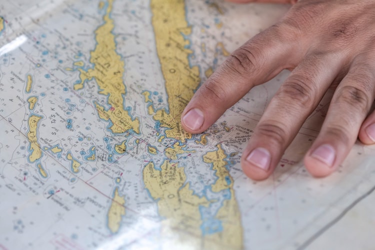
In the early days, seaman life depended heavily on landmarks and stars. As dramatic as that may sound, it’s true.
Although this was hardly an exact science, seasoned mariners were thought to map their voyage by the prominent constellations.
The sun’s east-west motion, or the path of the stars, was followed by vessels. Unfortunately, when the ship was out of sight of land, the navigator had no method to calculate longitude precisely and could not estimate how far east or west he was.
Estimates were based on travel time, a straightforward dead reckoning method still used by navigators today.
This method was how Phoenician sailors navigated in the year 2000 B.C. They would have had the early navigational advantage if they had used simple maps and the sun and stars.
Coastal navigators used the sounding reed (about 1500 BC in Egypt) to gauge the shallow water depths and the wind rises, identifying the eight principal winds and the nations from which they originated.
These early navigators had to make educated guesses about their location when they could not see land using a mix of depth soundings, the sun or stars, and the wind direction.

The first ocean journeys were undoubtedly terrible mistakes, with the ship being blown off course by an unexpected storm or a helmsman error.
Between 900 and 1000 AD, the Vikings frequently traveled to Iceland and Greenland, ostensibly utilizing the sun, stars, and wind as navigational aids.
But before we go all-out history classes here, picture yourself as a seafarer of years past. Yes, you could do it, but life at sea would undoubtedly be riskier if you only relied on the skies and your senses.
Today, navigation is aided by technology. If you’re pinpointing locations or accessing directions, there’s a high chance you’re using an Electronic Chart Display and Information System AKA ECDIS.
Ship work made efficient with ECDIS
As a replacement for paper charts, the Electronic Chart Display and Information System is a customized digital navigation computer.
It keeps a set of Raster Charts or Electronic Navigation Charts (ENCs) that can show the entire geographic data a crew needs to accomplish a voyage. An ECDIS, however, is more than just a digital substitute for conventional charts.
ECDIS maps often provide more data than earlier navigational aids and automate many crucial tasks. For instance, autonomous route planning and monitoring have significantly lessened the burden on the navigator.
With a functioning ECDIS, route correction is no longer time-consuming for navigation officers. In addition, electronic navigation’s accuracy, consistency, and dependability are advantages for security, effectiveness, and profitability.

The ECDIS uses a variety of modern navigational equipment along with powerful, specialized electronic navigation software to function. This includes devices like GPS, RADAR, ARPA, and many more.
Your ECDIS can be used to retrieve data from these sources, check tide tables, and access essentially all pertinent navigational data.
The ECDIS may obtain exact depth information and receive an early warning of potential risks by employing ENCs.
Calculating and entering information like squatting, which can draw a ship closer to the bottom, can help a crew get even more detailed information.
This data is used as input for several other automated processes, enabling exact route safety judgments and automatic safety warnings.
ECDIS and the ship’s chart types
An ECDIS performs various tasks depending on the sort of charts a ship is currently utilizing.
The most recent electronic navigational charts give ships access to data, automation, and safety capabilities.
1. Electronic Navigation Charts (ENC)
An ECDIS’s most common chart is an electronic navigation chart, commonly referred to as a vector chart.
This digital chart is entirely up to date and includes all the benefits of electronic navigation. Computer generation offers a lot of information and extra features like depth alerts and programmable displays.
The user can enable and disable certain ENC features as needed and instantly get more detailed information about any location or function.

Additionally, elements can be collapsed for a more straightforward, more expansive visual interface.
Overall, using electronic navigational charts for navigating makes it much simpler and more effective.
2. Raster charts
Raster ECDIS charts are far more straightforward than ENCs, which completely integrate the computer aspects of ECDIS.
The chart’s creator merely scans the paper chart to allow for electronic storage. Therefore, you won’t have more features or functionality when using a raster chart than paper charts.
It works the same way as downloading and viewing an image on your computer or phone.
The text and chart data are always visible, and zooming in or out has no discernible effect on any portion of the chart. The text and the image will also rotate when the chart is rotated.
When it’s hard to obtain ENCs for the entire duration of a voyage, you’ll need to supplement them with Raster charts and even paper charts.
How is the maritime industry benefiting from ECDIS?
While not flawless, ECDIS has numerous benefits over conventional paper charts.
1. Real-time processing
Even though humans have several advantages over computers, they cannot work as diligently and exhaustively as computers.
One of the significant advantages of ECDIS is that data is continuously processed and shown in real time.

The accuracy and output of an ECDIS are always accurate as long as the hardware and software are functioning correctly and the end user has supplied the relevant inputs.
This level of accuracy at each journey stage results in several observable advantages that have significant implications for the shipping sector.
2. Added safety
The damages incurred when a ship goes aground and needs repairs may seem incalculable.
The time the ship is out of commission results in a significant loss of revenue in addition to the expenditures of repairs. The potential for harm and death and the human implications are unimaginable in the worst-case scenario.
Electronic navigation systems significantly contribute to profit and human safety by giving accurate, real-time data on the journey.
3. Enhanced operational ease and efficiency
When navigators used manual equipment and charts, they spent a lot of time performing intellectually taxing tasks that required extraordinary attention to detail.
They needed to put a lot of effort into organizing and finding the information before they could even begin to act on it.
Modern navigators still need these abilities, although the availability of ECDIS equipment significantly lessens their workload. In addition, information is automatically compiled, which is straightforward to access via digital navigation aids.

The tedious task of chart rectification is also completely removed. Additionally, direct interaction with tools like AIS, Echo Sounding, ARPA, and others reduces waiting time and improves data clarity.
Seafarers like you can now concentrate and allot more time and energy to tasks you need to perform with your wits.
Using an ECDIS also means ship owners are able to maximize their profits.
Traditional navigation needed to maintain a specific margin of error to account for the lower level of precision attainable.
Losses from an abnormally high margin of error include a variety of things, including:
- Bringing lesser cargo than is required to ensure a secure voyage
- Traveling a much longer route than is necessary
- Scheduling challenges brought on by an incorrect ETA
These and other factors can be calculated considerably more precisely by a ship that uses an ECDIS, and the data available is updated continuously.
Therefore, computerized navigation enhances the prospect of increasing profits in addition to lowering the risk of losses.
To summarize
It’s incredible how far the maritime industry has grown over the years.
Now, seafarers enjoy bigger, stronger, and much more sustainable ships, stricter implementation of international safety standards, and upgraded technology like ECDIS to help them map out safer and more efficient routes.
Still, a successful voyage has always depended heavily on the human factor. Yes, even with such an innovative solution as ECDIS.
And that’s where you come in. If you’re a cadet capable of utilizing ECDIS or a seafarer ready to start your life at sea, look no further.
Industry leaders and shipowners trust Martide to fill vacant positions with qualified and talented seafarers like you. All you need to do is build a resume online via our platform and browse our vacancies today.

